Lots and lots of photos... Maybe I'm taking more!
I left Mae Hong Son and headed towards Mae Chaem which is a small town near the base of Doi Inthanon. I spent most of the day riding through roads like this:
 |
| On the right is Doi Inthanon, I think. I looks like that anyway. |
 |
| Some cows at the top of this pass (about 1300m) |
 |
| Wait... What country is this? Also, the sky was particularly clear and blue so the polariser almost removed it. |
I got to Mae Chaem and had a quick look around and checked in to the Mae Chaem Resort (400b/night for a bungalow). There's not a lot in this town but there are some backpackers and other tourists about, but not a huge amount of choice in places to stay. There are 4 other motorbikes here tonight too.
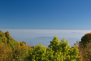
 |
| Doi Inthanon from the back of Mae Chaem Resort. It's 2565m tall and this photo was taken at 640m. It really doesn't look that impressive from here. |
 |
| The field behind my little bungalow. |
 |
| My bungalow! |
 |
| Doi Inthanon from a bit closer, at about 1200m here. |
So I had a whole day to go and explore the mountain and some of the waterfalls. It was cold in Mae Chaem so I put on all my warm gear because I thought it would only get colder at the top. Which it did, at about 2200m, and I know my bike isn't jetted quite right but it only lost a little bit of power towards 2400m. And then I made it to the top!
 |
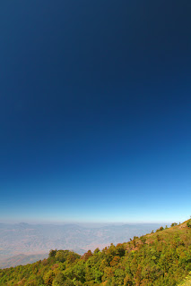
| The view from the carpark. This is about the only place you can see off the mountain from the top, there are trees surrounding it everywhere else. There's a military weather radar at the carpark too which has a big sign saying "Photography is Forbidden". |
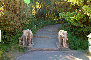 |
| Stairs leading up to the actual top, guarded by stone elephants. |
 |
| The elephants accept donations. |
 |
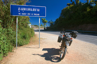
| The highest point I've been on land! A new personal record for me and my bike! The previous record was 2032m in Malaysia. |
And the actual highest point is just behind the sign at the memorial for King Inthawichayanon, who was the last king of Chiang Mai. His ashes were spread here.
 |
| The memorial. People would buy flowers further down the mountain and then leave them here. |
 |
| A little elephant, guarding his ashes. |
 |
| More of the memorial. |
They had a cafe near the top too so I wandered down and got some really high coffee.
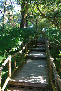 |
| Stairs to the cafe. |
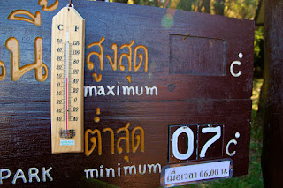 |
| The temperature. |
11 degrees... It felt much warmer than that. In the sun it was a lot hotter and I think it warmed up quickly. I had to remove a couple of layers from my jacket.
 |
| Ha! Beat that, bikes that have not been here! |
 |
| Looking over the edge... |
I headed down to the next big stop with a better view off the mountian. There are two Chedis on the top of the mountain (which you can see from Mae Chaem) for the King and Queen.
 |
| This is the Chedi for the King. |
I went to visit both of them which is rather easy because this is how you get up there:
 |
| Yup. Escalators. |
There are signs up warning not to do anything to stressful because of the altitude but this was only at 2200m. I felt fine but I still took the escalator!
 |
| Panorama time! Sky darkened by the polariser. On the left it was whiter cloud/smog/mist and the right had more smoke. |
 |
| Really dark sky, thanks to polariser. The sky was actually very bright and almost hurt to look at. |
 |
| That's Mae Chaem down in there. |
 |
| Looking across to the chedi for the Queen. |
 |
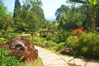
| The garden at the top. |
 |
| Odd little face smashed in thing... |
 |
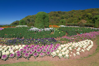
| Ornamental cabbages! Ha! I know what they are! Actually I'm not sure, there was a sign, but not sure if it was referring to these. |
 |
| The road down. |
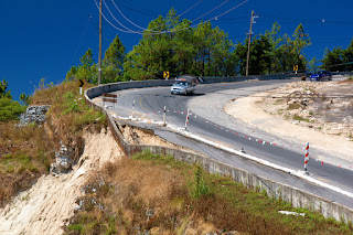 |
| More of the road... |
Then I went off to find some waterfalls!
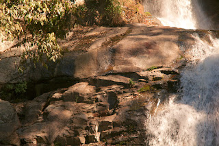
First off was Siriphum Falls.
 |
| This was in the park below the falls. |
 |
| More park. |
 |
| The actual falls... No idea how I get closer to there. |
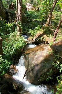
Next was Hui Sae Lueang Waterfall.
 |
| Now, right in the middle of this photo is a very rare bird apparently. A white crested something or another that migrates from Nepal. There was a group of birders there and one was very happy to see this and pointed it out to me. |
 |
| The actual falls. |
Next was just a short ride, and a lonnnnggg 500meter very hot trek to Mae Pan Falls. There was a fork in one part of the trail so I took the way that looked correct. This path ended up on the rocks, so I climbed over the rocks to try get a better view of the main falls. Then I could see a sign up a little higher, so after a short climb I ended up back on the path I should have taken...
 |
| Water! |
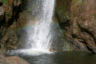 |
| Base of the falls with a little rainbow action. |
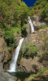 |
| The full falls! |
 |
| This was the path I should have taken... |
And then that was all my fun for the day...
Today I'll head back to Chiang Mai via some more waterfalls (and maybe the summit of Doi Inthanon again).


No comments:
Post a Comment